Thailand is a strong option for marine biodiversity research when the habitat, survey method, and local support match the project question. Coral reefs suit visual and photo-based monitoring, while seagrass, mangroves, estuaries, and offshore waters may require a different sampling design.
The Andaman Sea and the Gulf of Thailand offer contrasting marine environments, so location should be chosen before booking boats, dive services, or laboratory analysis.
Lower-cost shore-based observation can work for focused questions, while diving, vessel charters, genetic analysis, and remote sensing add capability and complexity.
Permissions, seasonal sea conditions, and protected-area rules should be checked early. A practical plan starts with a clear question and only then selects equipment, logistics, and research partners.
At a Glance
- Coral reef questions often fit belt transects, photo quadrats, underwater visual census surveys, and water-quality monitoring.
- Seagrass and mangrove questions may be better served by shore-based observations, habitat mapping, estuary sampling, and carefully planned field access.
- Permissions, weather, boat access, and local support can shape the field schedule as much as the scientific method.
| Survey approach | Typical equipment or support | Skill level | Time requirement | Relative budget level |
|---|---|---|---|---|
| Shore-based habitat observation | Field notes, mapping tools, basic water-quality equipment | Low to moderate | Short to moderate | Lower |
| Reef visual survey | Transect equipment, dive support, underwater data sheets | Moderate to high | Moderate | Moderate |
| Photo monitoring | Underwater camera, quadrat reference, image-management workflow | Moderate | Moderate | Moderate |
| Vessel-supported offshore work | Boat charter, safety planning, navigation, field equipment | High | Moderate to long | Higher |
| Laboratory or genetic analysis | Sample-handling plan, laboratory services, transport coordination | Specialized | Moderate to long | Higher |
What Thailand’s Coastal Habitats Can Reveal About Marine Biodiversity
Thailand provides access to coastal habitats that can support very different marine biodiversity questions. Coral reefs, seagrass meadows, mangroves, estuaries, and coastal waters should not be treated as interchangeable field sites. Each habitat changes what can be observed, how samples may be handled, and which research logistics are needed.
Andaman Sea vs. Gulf of Thailand: Why Location Changes the Research Design
Thailand has coastlines on both the Andaman Sea and the Gulf of Thailand. These contrasting marine environments can affect site access, sea conditions, visibility, and the practical timing of survey work. A project manager should choose a broad coast only after deciding whether the study depends on diving, boat access, shallow-water work, or repeated monitoring.
Do not assume that a site will be reachable or suitable on a preferred date. Monsoon patterns and local sea conditions can influence diving safety, boat travel, and survey consistency. Current weather, access restrictions, and seasonal closures need site-specific verification before field logistics are confirmed.
Reef, Seagrass, Mangrove, and Estuary Studies at a Glance
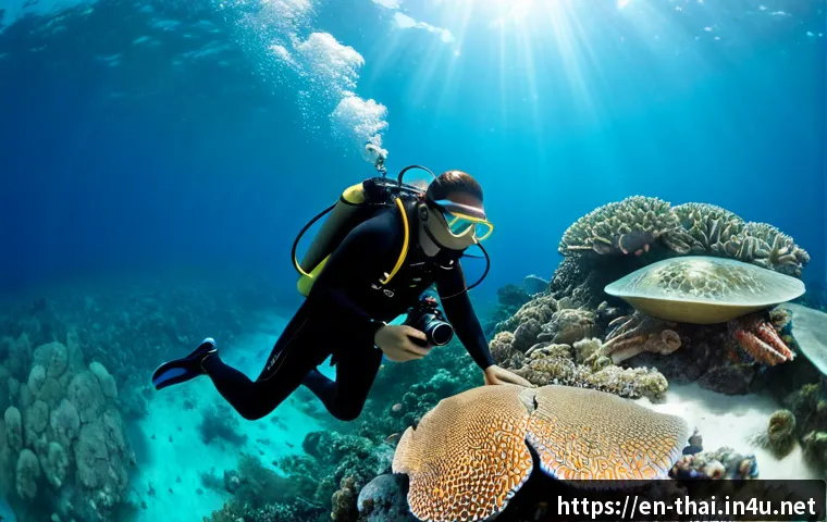
Coral reef research is commonly suited to belt transects, photo quadrats, underwater visual census surveys, and water-quality monitoring. These methods can support structured observations, but they require consistent procedures across divers, survey areas, and repeat visits.
Seagrass ecosystems are relevant where researchers are examining feeding habitat for dugongs or nursery habitat for marine species. A field plan should minimize trampling and avoid unnecessary disturbance to the meadow. Mangrove areas are widely studied for coastal biodiversity, fisheries, shoreline protection, and carbon storage, yet access conditions and tidal timing can make planning essential.
Estuaries and coastal waters can be useful when the question concerns the connection between habitats, water conditions, or species use of nearshore areas. The best habitat is not the most famous location; it is the one that directly supports the research question.
Three Quick Planning Answers for New Research Teams
- Need species observations on a reef? Start by considering a standardized visual survey or photo-monitoring design with appropriate dive support.
- Need habitat context with limited resources? Consider shore-based observations and a focused sampling design before adding vessel time or laboratory services.
- Need samples, drones, or work in a protected area? Verify permissions first, because field activity may require approval from relevant Thai authorities.
Compare Field Methods, Equipment Needs, and Budget Value
The right method is the one that produces usable data without building unnecessary cost into the project. Research equipment, laboratory services, vessel charters, and conservation consulting should be selected after the team defines what evidence is actually needed.
Visual Surveys, Photo Monitoring, eDNA, and Water-Quality Testing
Underwater visual census surveys and belt transects can be practical for direct field observations when trained personnel and safe diving conditions are available. Photo quadrats can create a repeatable visual record, provided the image area, timing, and capture method remain consistent.
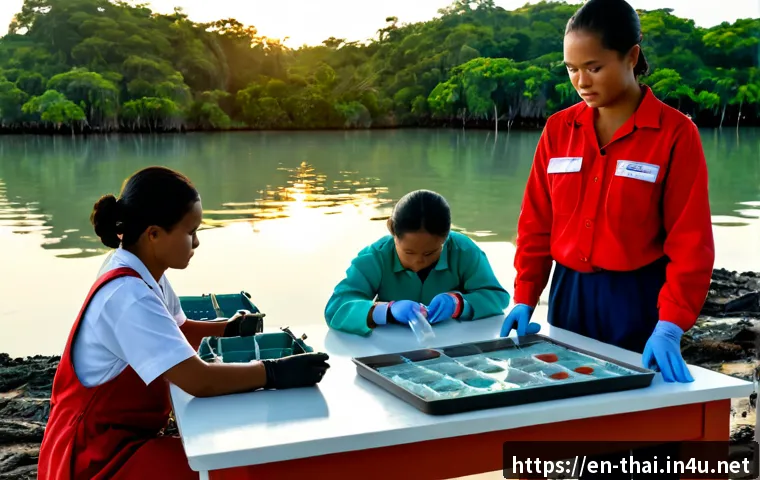
Water-quality monitoring may add useful context to reef or coastal studies. Genetic analysis approaches such as eDNA can require specialized sample handling and laboratory coordination. They should be considered when laboratory output answers a question that observation alone cannot answer, rather than being added simply because the technology is available.
Before sourcing equipment or laboratory testing, list the expected output: a habitat record, species observation dataset, photo archive, water-quality result, or sample-based analysis. This makes it easier to compare supplier specifications and service scopes.
Relative Costs: Shore-Based Work, Diving Surveys, and Vessel-Supported Projects
Shore-based work may reduce reliance on boat charters and dive operations, although it still needs safe access, a clear sampling plan, and suitable conditions. Diving surveys add requirements for trained personnel, dive safety, equipment checks, and local conditions. Vessel-supported projects can expand site options but introduce boat scheduling, weather exposure, transport of equipment, and potentially more complex coordination.
Total project cost cannot be estimated reliably without details such as team size, vessel time, diving needs, laboratory analysis, insurance, and local partnerships. Avoid choosing a method based on a generic budget label alone. Request a clear scope from boat operators, dive teams, laboratories, and environmental consulting providers before comparing options.
When Laboratory Analysis or Remote Sensing Adds Meaningful Value
Laboratory analysis is most useful when it directly supports the sampling objective and the team can maintain proper sample handling. Remote sensing can be valuable when the study needs a broader habitat perspective, but it does not replace field validation. In both cases, decide early how results will connect to field observations.
A useful question is: Will this added service change a decision, strengthen a dataset, or answer a question that field observation cannot? If the answer is unclear, a simpler field method may be the better starting point.
Build a Practical Research Plan Before Going to the Coast
A field plan should connect the research question to a realistic sampling design, equipment list, and support model. This reduces the risk of arriving at a site with the wrong method, incomplete permissions, or an unsafe schedule.
Define the Research Question, Target Species, and Sampling Design
Write the question in operational terms. Identify the habitat, target species or community, observation unit, and survey method. For example, a reef monitoring project needs a consistent approach to transects, photo quadrats, or visual census observations; a mangrove or seagrass study needs a plan that recognizes access and disturbance concerns.
Keep the design consistent across sites and survey dates whenever possible. Changing effort, equipment setup, observer approach, or survey area without recording the change can weaken comparisons later.
Permissions, Protected-Area Rules, and Collection Restrictions to Verify
Field research involving protected areas, wildlife, specimen collection, drones, or marine equipment may require permission from relevant Thai authorities. Requirements, fees, approval timelines, and restrictions can vary by activity and location. These details should be confirmed directly for the specific site and project, rather than assumed from a previous study or a general travel plan.
Build permit checks into the project timeline before arranging non-refundable field logistics. If local coordination is required, confirm who is responsible for each approval, document, or communication step.
Safety Planning for Diving, Boats, Weather, and Sample Handling
Safety planning is part of data quality. Diving conditions, boat access, visibility, and sea state can determine whether a planned survey can be conducted consistently. Establish a practical decision process for postponing work when conditions are unsuitable.

For samples, decide in advance who labels, stores, transports, and records each item. For diving and boat work, clarify roles with the local operator or dive team. A simple written field protocol can prevent confusion when schedules change.
Avoid Common Fieldwork Mistakes in Tropical Marine Environments
Many marine fieldwork problems are not caused by the research question. They result from avoidable gaps in timing, access, environmental care, or standardization.
Planning Around Monsoon Conditions, Tides, Visibility, and Access Limits
Monsoon patterns and local sea conditions can affect visibility, boat access, diving safety, and survey timing. A project should allow room for changes instead of relying on a single narrow field window. Tidal conditions can also matter for mangrove, seagrass, estuary, and nearshore access.
Check current site conditions and restrictions shortly before deployment. Historical expectations are not a substitute for current local information.
Reducing Disturbance to Reefs, Seagrass Beds, and Wildlife
Research activities should be designed to reduce unnecessary disturbance. On reefs, avoid contact with coral and maintain careful control of field equipment. In seagrass areas, limit trampling and avoid disturbing habitat beyond what the approved method requires. Wildlife-related activity needs especially careful attention to applicable permissions and local rules.
Data-Quality Problems Caused by Inconsistent Survey Effort
Inconsistent survey effort can make results difficult to interpret. Examples include changing transect lengths, using different photo methods without documentation, surveying at very different conditions, or varying the number of observers without a clear protocol.
Use a field checklist for every visit: location, date, method, equipment, conditions, observer roles, and any departure from the planned design. This is often more valuable than adding another complicated tool at the last minute.
Choose the Right Support Model for Your Project
The best support model depends on the team’s expertise, field requirements, timeline, and need for local coordination. Hiring every service is not always necessary, but trying to manage specialized work without suitable capacity can create delays.
Student Project, University Study, NGO Monitoring, and Commercial Environmental Assessment
A student project may benefit from a tightly focused question and a manageable observation method. A university study may need more formal sampling, laboratory coordination, or repeated surveys. An NGO monitoring program may prioritize repeatable methods that can be maintained over time. A commercial environmental assessment may require a broader logistics plan, specialist support, and documented coordination.
Choose the smallest support model that still meets safety, permission, and data-quality needs.
When a Local Boat Operator, Dive Team, Lab, or Environmental Consultant Is Worth the Cost
Local boat support can be valuable when offshore access, timing, and safe transport are central to the study. Dive support may be appropriate when the project relies on underwater surveys and the team needs operational assistance. Laboratory services matter when sample analysis is integral to the question. Environmental consulting can be useful when project coordination, regulatory verification, or specialist field planning exceeds in-house capacity.
Ask providers to define what is included: vessel time, crew support, equipment, safety arrangements, sample handling, reporting, or local research coordination. This makes comparisons more meaningful than choosing by a headline quote alone.
Questions to Ask Before Selecting a Fieldwork Partner
- Do they understand the habitat and field method being proposed?
- What support is included for boats, diving, equipment, or sample handling?
- How will weather or access changes be handled?
- Can they clarify which permits or protected-area rules need verification?
- Who is responsible for field records, safety procedures, and schedule coordination?
Selection Criteria and Comparison Summary
Choose a fieldwork setup by checking research fit, site access, team competence, permission needs, weather flexibility, and data handling capacity. A minimum viable setup may use a focused habitat question, standardized observation, and basic field logistics. A full-scale monitoring program may add diving, vessel charter, laboratory testing, remote sensing, and local research coordination when each service supports the final objective. For boat, dive, laboratory, or consulting options, review the provider’s official scope and detailed conditions before committing.
Closing Thoughts
Marine biodiversity research in Thailand works best when the method follows the habitat rather than the other way around. Reef, seagrass, mangrove, estuary, and coastal-water projects each need different practical decisions. Start with a precise question, verify permissions and local conditions, then select only the equipment and partner support that the study genuinely requires. That approach helps protect both the research schedule and the marine environment.
Useful Information to Keep in Mind
1. Seagrass meadows can provide feeding habitat for dugongs and nursery habitat for various marine species.
2. Mangroves are relevant to biodiversity, fisheries, shoreline protection, and carbon storage research.
3. Reef work commonly uses belt transects, photo quadrats, visual census surveys, and water-quality monitoring.
4. Site-specific sea conditions may change field access and survey timing.
Important Notes
Exact permit requirements, approval timelines, fees, access restrictions, seasonal closures, weather conditions, and project costs require direct confirmation for the individual site and activity. Species abundance, coral condition, and water-quality status should not be assumed without recent site-specific survey data. Any collection, drone operation, protected-area work, wildlife-related activity, or specialized marine equipment use should be verified with the relevant Thai authorities before field deployment.
Frequently Asked Questions
Q1. What is the best area in Thailand for coral reef and seagrass research?
A1. There is no single best area for every project. Thailand’s Andaman Sea and Gulf of Thailand offer contrasting marine environments, so the suitable location depends on the research question, target habitat, access conditions, local sea conditions, and applicable restrictions. Confirm recent site information before selecting a field base.
Q2. How much should a marine fieldwork project in Thailand budget for boats, diving, and lab testing?
A2. A reliable total cannot be set without the project scope. Costs depend on team size, vessel time, diving needs, laboratory analysis, insurance, equipment, and local partnerships. Request detailed service scopes from boat operators, dive providers, laboratories, and research coordination partners before comparing options.
Q3. Do foreign researchers need permits to collect marine samples or work in protected coastal areas?
A3. Permissions may be required for protected areas, wildlife work, specimen collection, drones, and some marine equipment activities. Requirements and timelines can vary by location and activity, so foreign researchers should verify the current rules with the relevant Thai authorities and coordinate early with any local partner.